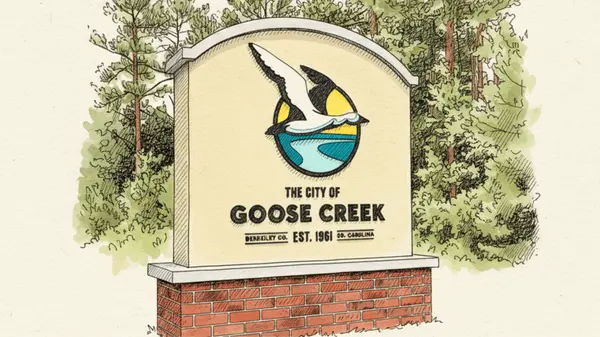
How Did Round O, SC Get Its Name?
Origin of the Name “Round O”
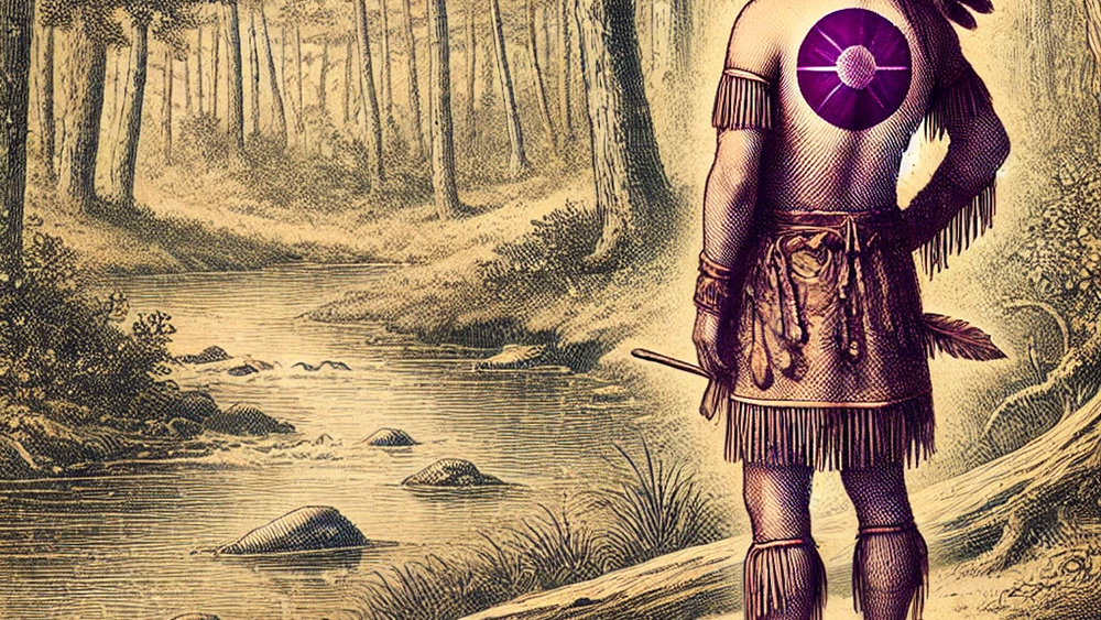
image: Artist rendering of what the native american, "Round O" may have resembled.
Round O, South Carolina’s unusual name traces back to local folklore. According to tradition, early settlers named the community after a local Native American whose full name was considered too long to pronounce. This individual was known for painting a distinctive circular design on his torso, leading villagers to call him “Round O”. The community eventually adopted this as its name.
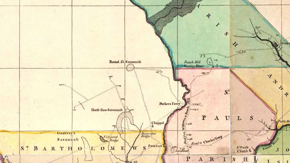
Historical evidence shows the name was in use by the mid-18th century. A 1757 colonial map by J.G.W. De Brahm labels a nearby geographical feature as “Round O Savannah” west of the Edisto River, placing the name in the context of that era. In some historical records the settlement was referred to simply as “Round,” though the name Round O is the one that endured.
Historical Overview
Round O is located in Colleton County, an area that was part of St. Bartholomew’s Parish in colonial South Carolina. Beginning in the early 1700s, this region was developed for large plantations growing rice and indigo – lucrative cash crops in the Lowcountry. Planters depended on enslaved African labor, and in the surrounding Lowcountry parishes enslaved Black people soon outnumbered white colonists. Round O, situated on the west side of the Edisto River, would have been within this plantation economy during the colonial and antebellum periods.
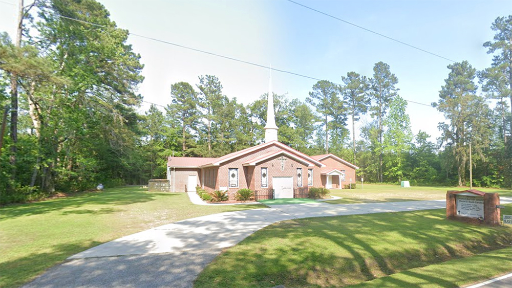
image: Canaan Baptist Church in Round O, SC
By the 19th and early 20th centuries, Round O grew into a small rural community. A U.S. Post Office was established (today serving ZIP code 29474), and churches such as Canaan Baptist Church and Mount Sinai Baptist Church became focal points of local life. The presence of these institutions indicates a stable settlement through the late 1800s and early 1900s. In the mid-20th century, transportation infrastructure recognized Round O’s existence: a spur of State Highway 64 (designated SC 64Y) was built to connect Round O around 1939–1942.
Despite such developments, Round O never incorporated as a municipality; it remained an unincorporated crossroads under county governance. No major battles or historically famous events took place in Round O – its story is one of steady, modest rural development rather than headline-making events.
By the 21st century, Round O has retained its small size and rural character. It remains an unincorporated community with a population of only about 2,100 residents, reflecting limited growth over time. The town’s history and identity continue to be defined by its early heritage and continued role as a quiet agricultural community in the Lowcountry.
Demographics and Socioeconomic Profile
Round O’s demographic and economic profile reflects a small, rural South Carolina community. Key statistics include:
- Population: Approximately 2,136 residents (circa 2020). The community is sparsely populated, contributing to Colleton County’s overall low density (~34 people per square mile). The population is roughly evenly split between men and women.
- Median Income: Household incomes are modest. The median household income in the area is on the order of $33,000 (Colleton County median), which is below national averages. This indicates a primarily working-class, rural economy. A significant portion of the population lives at or near the poverty line (over 20% county-wide in recent estimates). Many residents likely work in agriculture, forestry, or commute to jobs in nearby towns (such as Walterboro), given the limited commercial activity in Round O itself.
Education and age distribution data specific to Round O are not separately reported (as the community is unincorporated and not a census-designated place), but they are expected to align with broader county trends. Colleton County has a median age in the low 40s and a high school graduation rate around the state average, suggesting Round O’s population is a mix of families and older adults typical of a long-established rural community. Overall, the statistics paint a picture of a small, tight-knit population with deep local roots and a modest economic base.
Cultural and Geographic Features
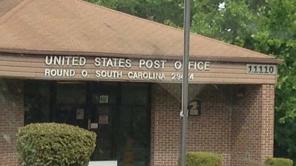
Image: The Round O Post Office in Colleton County.
The community’s small United States Post Office (ZIP code 29474) serves as a central landmark, symbolizing Round O’s rural character. Round O is home to only a few public facilities – notably the post office pictured above and at least two churches, Canaan Baptist and Mount Sinai Baptist, which lie within the community. These institutions double as social hubs, hosting church gatherings and community events that knit together the residents of this spread-out rural area. There are no incorporated town centers or large businesses in Round O; daily life revolves around family farms, local churches, and the occasional convenience store or local service in the vicinity.
Geographically, Round O lies in the heart of South Carolina’s Lowcountry region. The terrain is flat coastal plain, only about 36 feet above sea level on average. The area is characterized by pine forests, wetlands, and farm fields typical of the Lowcountry. The Edisto River flows just east of Round O, and historically the “Round O Savannah” was noted on the west bank of the Edisto– underscoring the community’s proximity to this significant river. Being near the Edisto means the land is fertile but also low-lying; cypress swamps and small creeks dot the landscape. Wildlife is abundant in the surrounding countryside, and the location is not far from the ACE Basin (the Ashepoo-Combahee-Edisto Basin), one of the largest undeveloped estuarine ecosystems on the East Coast, which influences the local environment.
Round O sits near the intersection of U.S. Highway 17 Alternate and Round O Road, essentially a rural crossroads. This location puts it roughly 10 miles northeast of Walterboro (the county seat) and a similar distance south of Cottageville. Despite its small size, the community is marked on maps and road signs, and travelers through Colleton County might pass the Round O junction. The quiet nature of the area and its scenic country roads are representative of rural South Carolina. Residents often have to drive to larger towns for extensive services, but the tranquility and close community ties are a defining feature of Round O’s local culture.
Notable People and Fun Facts
Round O is not widely known for famous individuals – no celebrities or historical figures of national renown hail specifically from this tiny community. Its significance is more local and regional, tied to families who have lived in the area for generations. Longtime residents – often descendants of those who farmed the land – carry on traditions of rural life, but their names are not commonly found in history books. Instead, Round O’s claim to fame is its name itself, which frequently piques curiosity. The distinctive name has landed Round O on lists of towns with unusual or amusing names. A 2015 news article, for example, highlighted Round O in a lighthearted look at “funny” town names, cementing its place in trivia nights and travel blogs about odd place names. This little community’s name tends to stick in people’s minds even if they have never visited.
In terms of local lore and identity, Round O’s name origin story (the Native American with a circle emblem) is the community’s most famous legend, passed down over the years. Locals embrace the uniqueness: the Round O post office sign is often a photo opportunity for visitors, and the name sparks conversations. Aside from its name, Round O’s “notability” comes from its steadfast existence as a close-knit rural community.
The lack of stoplights, the single post office, and the prominent churches all paint a picture of small-town Southern life. While it may not boast notable events or people in the conventional sense, Round O is notable for its continuity and charm – a place where history is quietly preserved in the daily lives of its people. The community’s residents take pride in their corner of Colleton County, contributing to the tapestry of South Carolina’s Lowcountry heritage through their way of life.
Overall, Round O, South Carolina is a tiny dot on the map with a big story behind its name. From its 18th-century moniker born of folklore, through its years as a plantation-area settlement, to its present-day profile as a humble rural locale, Round O offers a fascinating glimpse into local history and culture. It may be small in size, but it carries the legacy of the Lowcountry’s past and the enduring spirit of a community defined by its people and their unique place in the world. We at The Family Real Estate Group encourage you to explore the charm of this small Southern town the next time you're in the area.
Sources
- Colleton County, South Carolina – Wikipedia (for historical context on St. Bartholomew’s Parish, population, and demographics)en.wikipedia.orgen.wikipedia.orgen.wikipedia.org.
- Round O, South Carolina – Wikipedia (for population, name origin tradition, location, and general info)en.wikipedia.org.
- Round O, South Carolina – Spanish Wikipedia (es.wikipedia) (for confirmation of local features: churches and post office)es.wikipedia.org.
- J.G.W. De Brahm’s 1757 Map of South Carolina and Georgia (historical reference to “Round O Savannah”)en.wikipedia.org.
- South Carolina Highway Department records – Wikipedia (mention of SC 64Y spur route to Round O, c.1939)en.wikipedia.org.
- U.S. Census Bureau, Colleton County QuickFacts (population and density)en.wikipedia.org and 2000 Census (median income data)en.wikipedia.org. (Data via secondary source)
- The Miami News, “Some towns sure have funny names” (May 19, 2015) – referenced via Wikipedia as noting Round O’s name in an articleen.wikipedia.org.
Categories
Recent Posts